The early morning glow slowly colours in our surroundings. It is early and we are on our way to the Namibian border. We park in front of the border office, get out of the car and smile at each other when we see the numbered offices: 1 til 6. All different cubicles for different authorities. We prepare for the worse. But surprisingly we find ourself walking from office to office in no time. Before we know it our passports are stamped, the car is checked and we’re driving into Namibia.
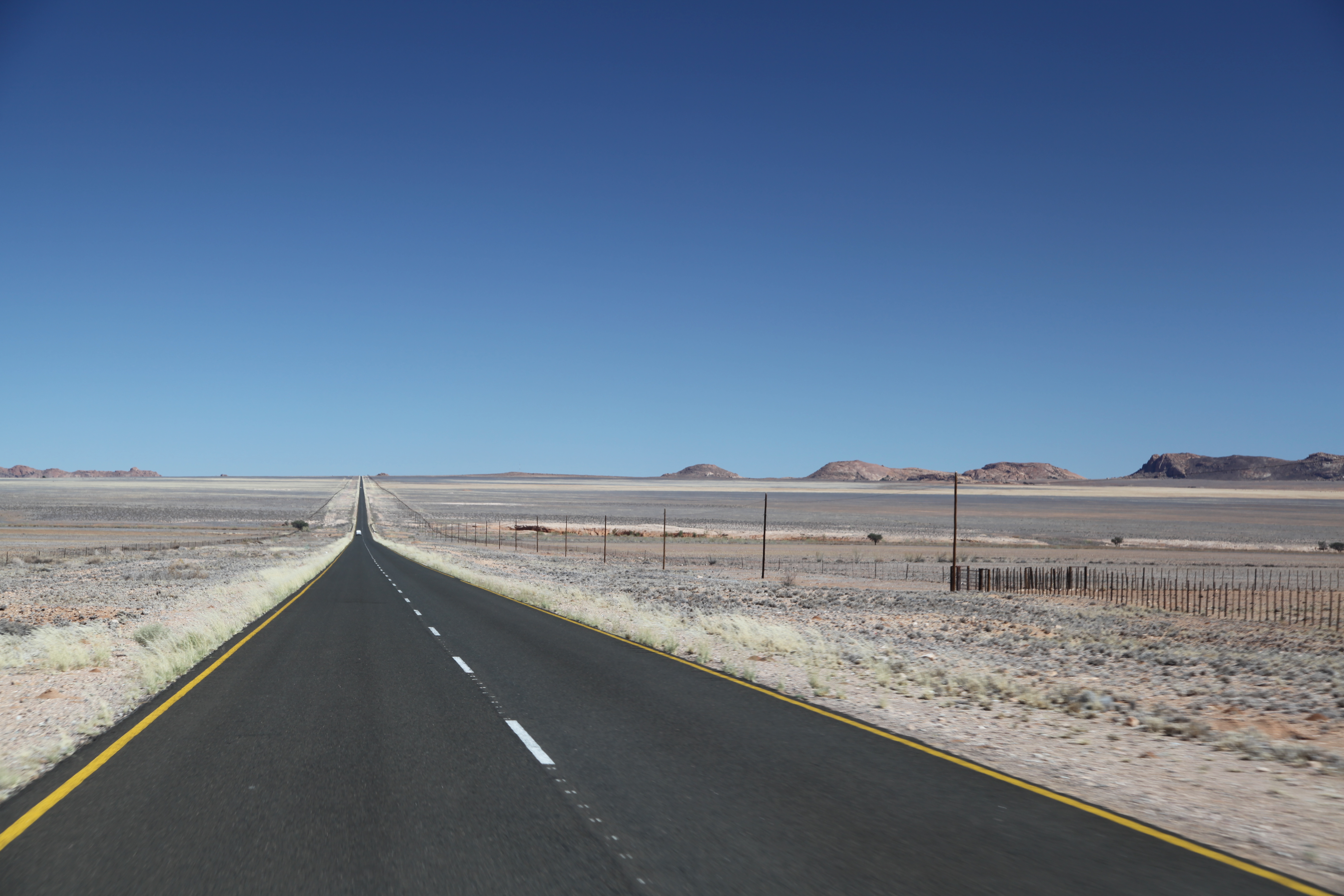
Our first impression is: empty. It is dry and the views seem endless. We drive passed the first small villages and directly to Fish River Canyon and the Ai-Ais Hotsprings.
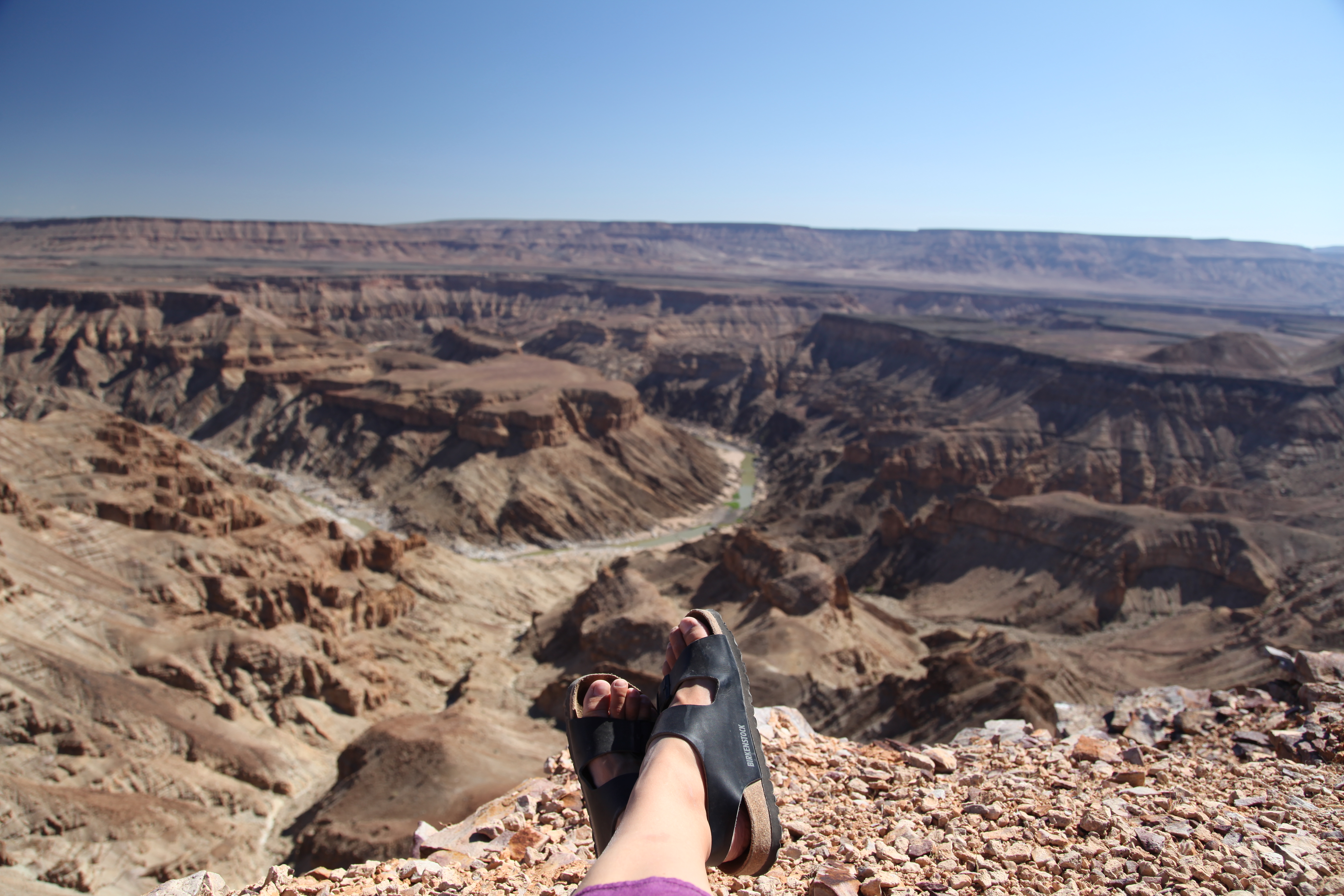
The Fish River Canyon (Afrikaans: Visrivier Canyon or Visrivier Afgronde, German: Fischfluss Canyon), is located in the south of Namibia. It is the largest canyon in Africa, as well as the second most visited tourist attraction in Namibia. It features a gigantic ravine, in total about 100 miles (160 km) long, up to 27 km wide and in places almost 550 meters deep.
The Fish River is the longest interior river in Namibia. It cuts deep into the plateau which is today dry, stony and sparsely covered with hardy drought-resistant plants. The river flows intermittently, usually flooding in late summer; the rest of the year it becomes a chain of long narrow pools. At the lower end of the Fish River Canyon, the hot springs resort of Ai-Ais is situated.
Public view points are near Hobas, a camp site 70 km north of Ai-Ais. This part of the canyon is part of the Ai-Ais/Richtersveld Transfrontier Park. The other 90 km of this canyon are privately owned.
The emptiness goes on. Luderitz is a small village which is know for its diamant industry and early German settlement We stay here for two days, look around and enjoy the peace and quiet. It feels like the whole population of Luderitz went to visit family, because nothing is happening here.
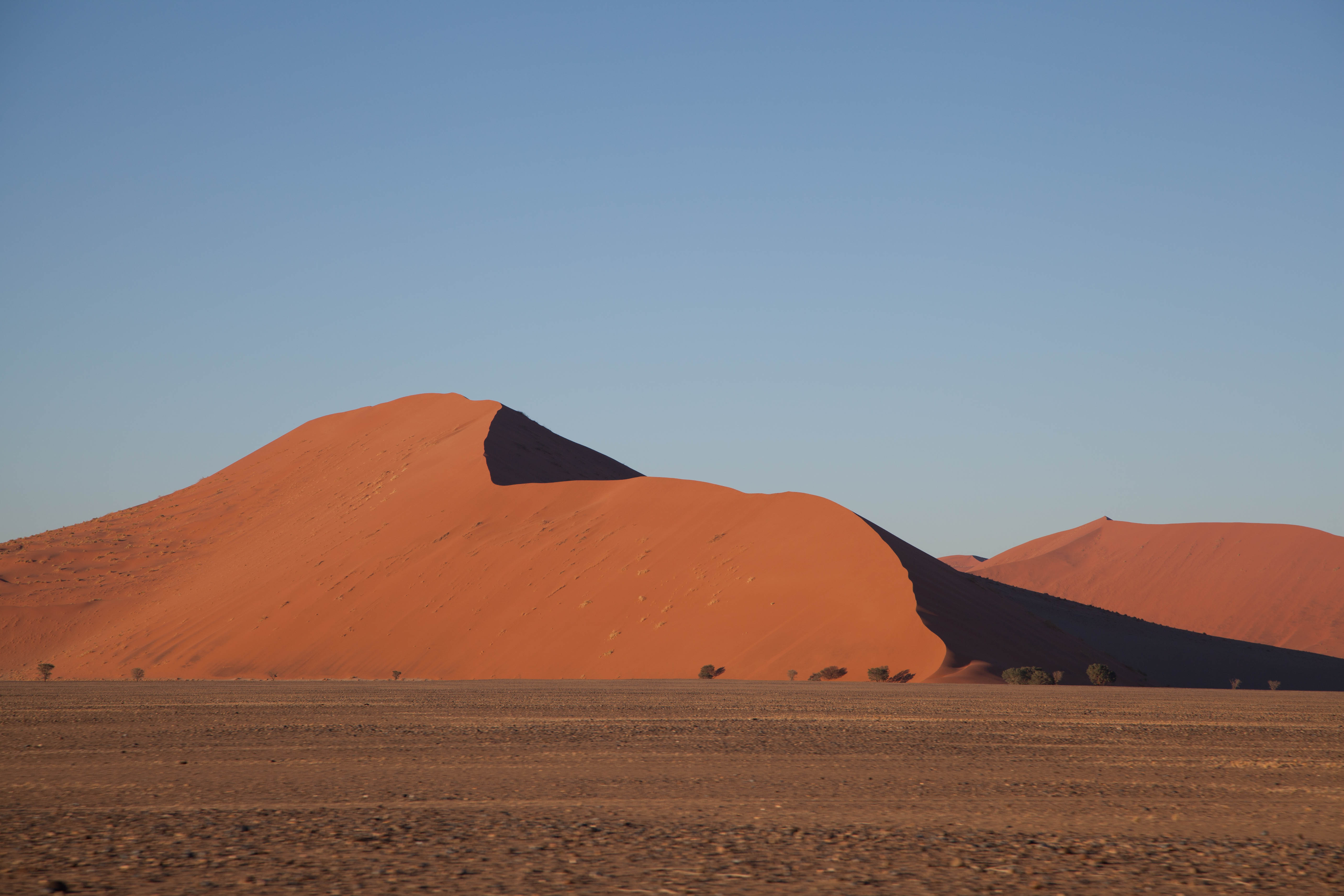
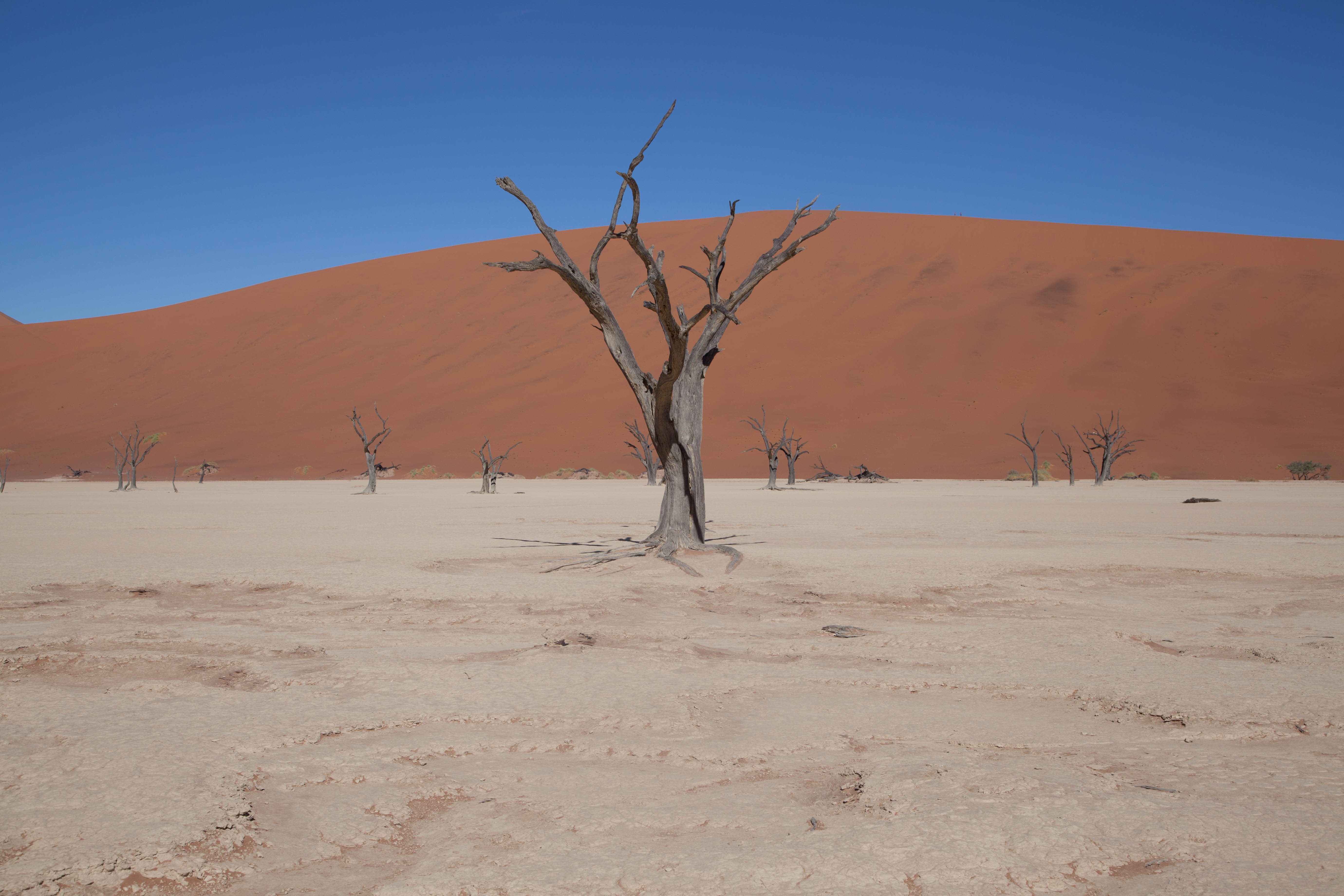
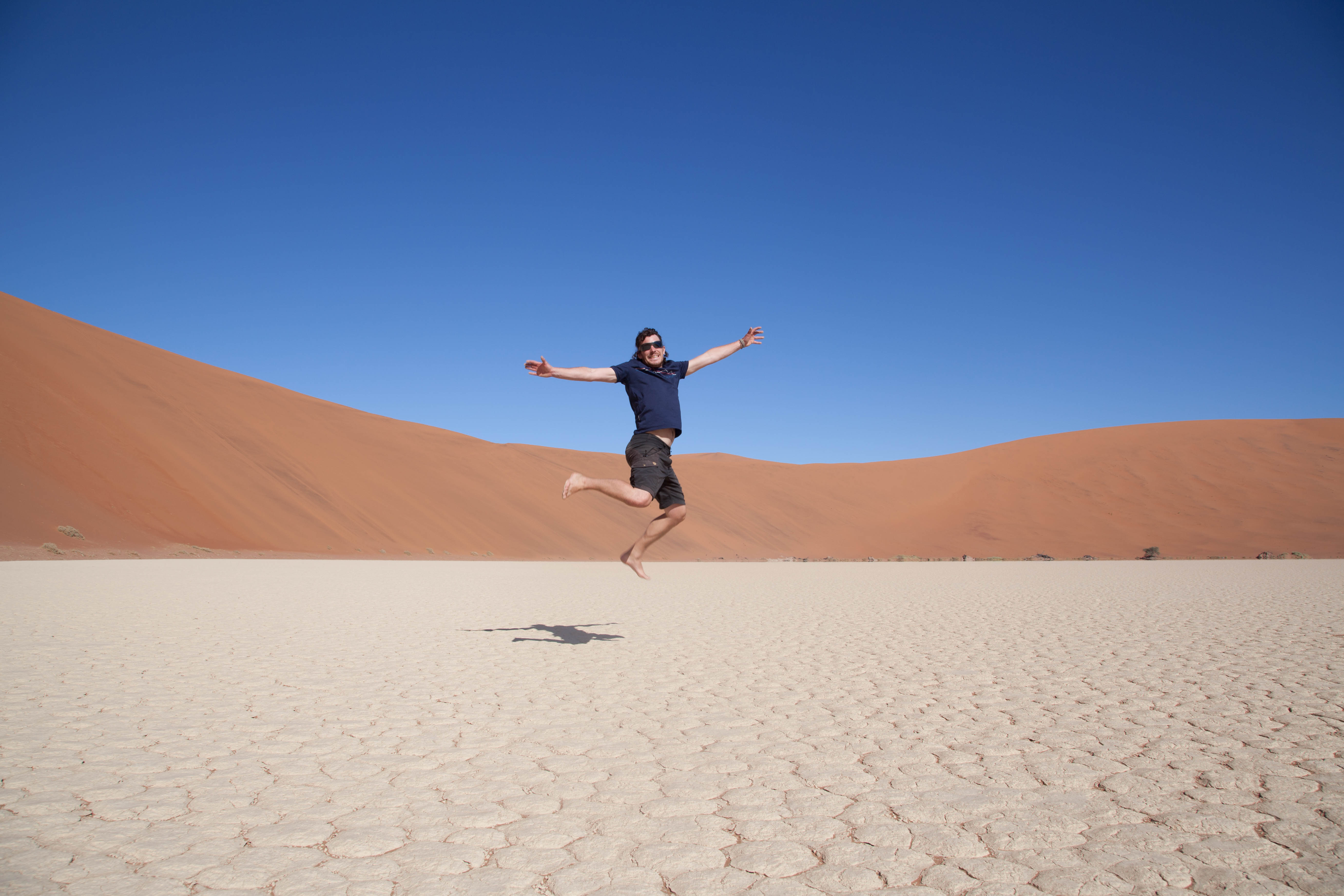
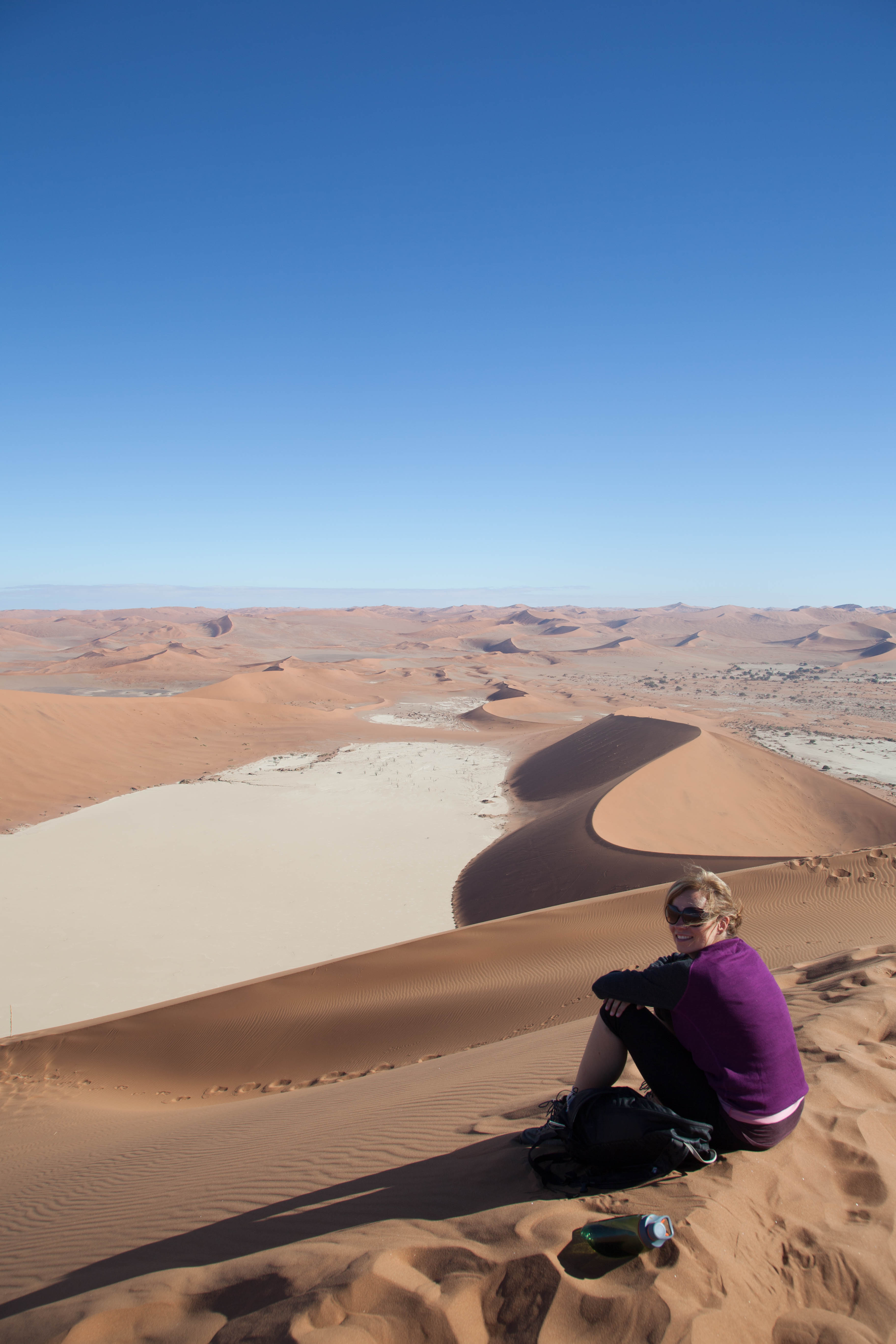
We leave Luderitz to go to Sossusvlei, a place amongst the sand dunes. Sometimes it gets a little bit of rain which will then run down the 700m high sandslopes towards the lowest point. A layer of clay will form on this lowest point which will hold the water like a sponge. It’s like an oases surrounded by sanddunes.
Sossusvlei (sometimes written Sossus Vlei) is a salt and clay pan surrounded by high red dunes, located in the southern part of the Namib Desert, in the Namib-Naukluft National Park of Namibia. The name “Sossusvlei” is often used in an extended meaning to refer to the surrounding area (including other neighbouring vleis such as Deadvlei and other high dunes), which is one of the major visitor attractions of Namibia.
The name “Sossusvlei” is of mixed origin and roughly means “dead-end marsh”. Vlei is the Afrikaans word for “marsh”, while “sossus” is Nama for “no return” or “dead end”. Sossusvlei owes this name to the fact that it is an endorheic drainage basin (i.e., a drainage basin without outflows) for the ephemeral Tsauchab River.
On our way to Sossusvlei we see a large yellow cloud coming towards us. As everything around us turns darker and we get closer we see that it’s a sandstorm. We turn our lights on and by the time it hits us, it is like we just passed a large truck doing 140km/h. We stop and wait for the dust to clear up. A couple of minutes later it’s like nothing ever happened and we’re looking at a clear blue sky again.
On our way we see gemsbokken, springbokken, zebras and ostriches.